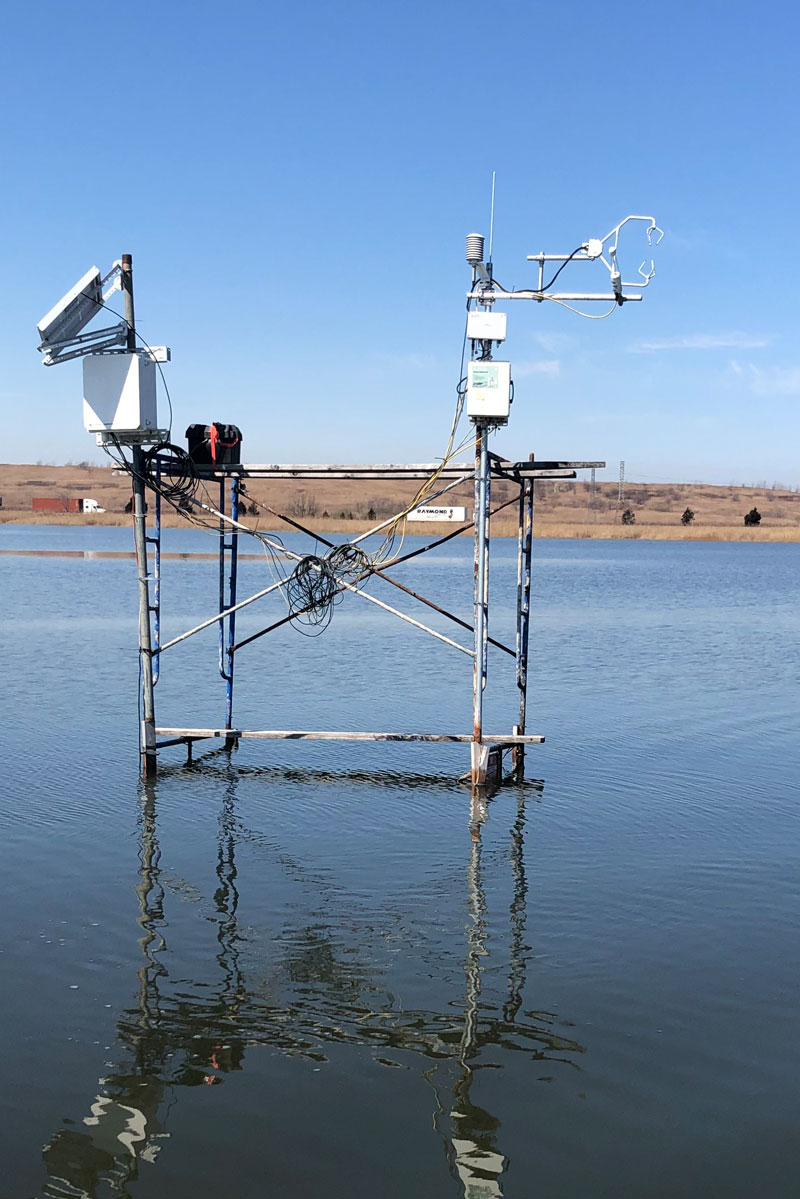
As the 2020 growing season kicks in and the Meadowland marshes gear up for the spring, it’s time to deploy MRRI’s carbon flux sensors.
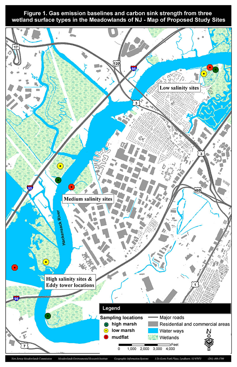
As part of a grant agreement with the Environmental Protection Agency (EPA, CD- 96284501-0) MRRI scientists measure carbon sequestration potential of three major habitats of the lower Hackensack River Estuary: mudflat, low marsh and high marsh habitats.
Low marsh habitats are dominated by the tall, dense stands of the smooth cordgrass (Spartina alterniflora), while at the high marsh habitat saltmeadow cordgrass (Spartina patens) and desert saltgrass (Distichlis spicata) share dominance.
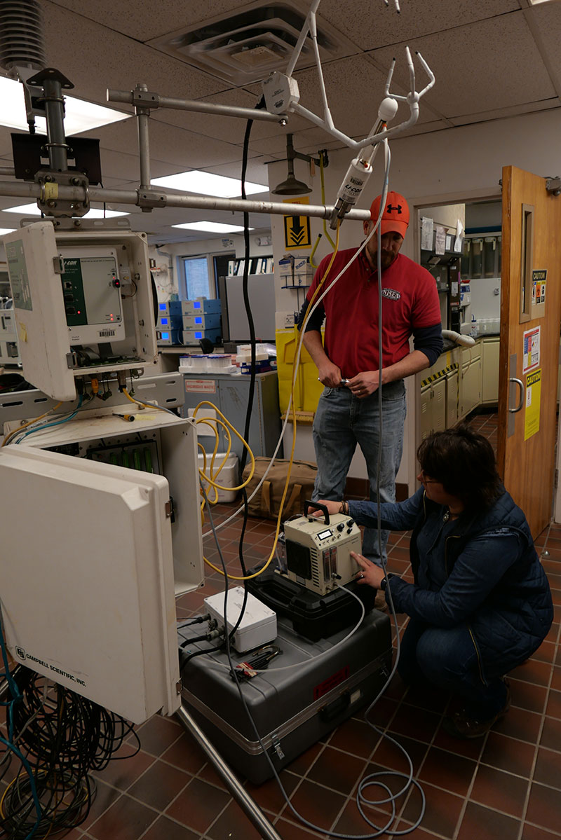
The study aims to explore the differences in carbon uptake between the vegetated habitats and the mudflat by utilizing open path CO2/H2O gas analyzers (one LI-7500A: LiCOR Inc., and 2 IRGASON: Campbell Inc. sensors) mounted on eddy covariance towers. The sensors capture CO2 fluxes on the vegetation-atmosphere interface based on air CO2 and water vapor concentration, ambient temperature and pressure at a 20records/sec rate, 24/7.
The raw data is collected monthly at the stations and converted into .dat files at MRRI’s GIS lab. CO2, and H2O fluxes are then calculated and averaged into an hourly dataset using EddyPro open source software. Net Ecosystem Exchange (NEE) and annual Gross Ecosystem Production (GEP) are calculated at the end of the annual data collection, and those values serve as a basis of the habitat comparison.
The ultimate goal of the project is to capture the marsh canopy’s annual carbon uptake rate at each of the three habitat types and to better understand their carbon sequestration potential and the role they play in the region’s carbon footprint.
(Please click on the embedded site map photo to view the full resolution of the site map)