Water Quality Monitoring
Our Projects
Seasonal Water Quality Monitoring
The Meadowlands Environmental Research Institute has monitored the quality of water within the District since 1993. The monitoring project was established to provide a general assessment of overall water quality in the Meadowlands estuary due to the legacy of contamination from landfills located within the District. The monitoring efforts also identify any large-scale, long-term trends in water quality, and detect any acute water quality problems.
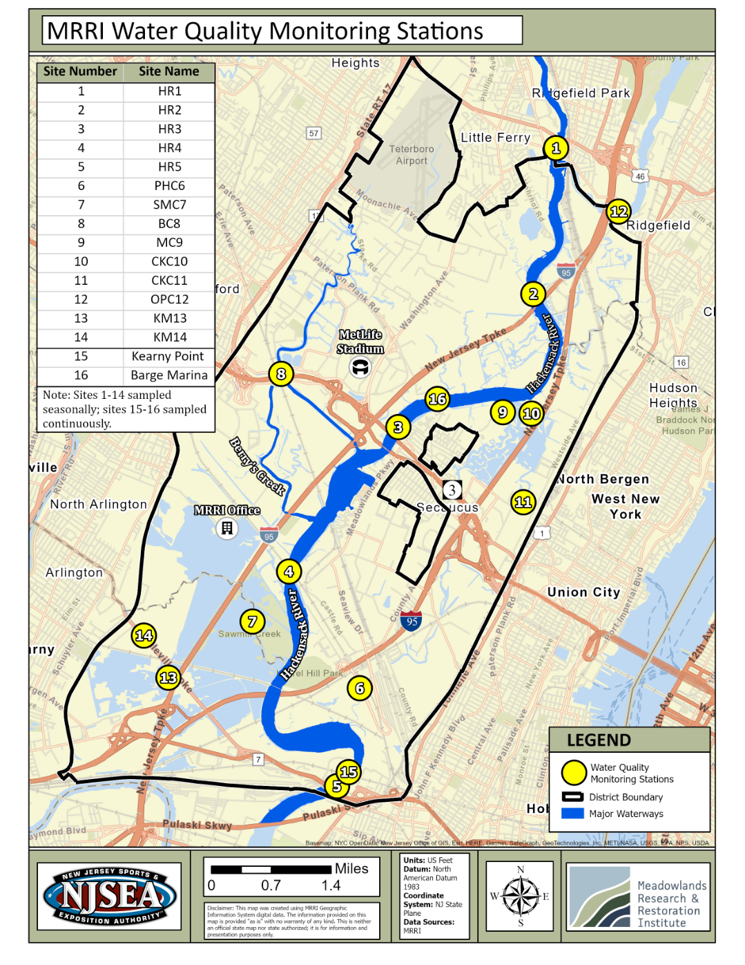
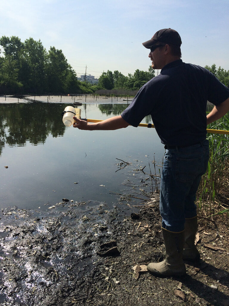
Water samples are collected at 14 sites on the lower Hackensack River and its tributaries every quarter. The map below shows the location of these sites within the district.
Water samples in the field are analyzed for temperature, dissolved oxygen, conductivity, salinity, and pH. The water samples are then brought back to the Meadowlands Environmental Research Institute laboratory for additional analysis. The parameters being monitored are: ammonia, 5-day Biochemical Oxygen Demand, Chemical Oxygen Demand, hardness, Total Dissolved Solids, Total Suspended Solids, turbidity, fecal coliforms, chloride, bromide, nitrate, nitrite, sulfate, phosphate, sodium, potassium, calcium, magnesium, cadmium, chromium, copper, iron, lead, zinc, manganese, nickel and mercury. The metal species are analyzed for both the total and dissolved forms. The MRRI lab where samples are analyzed is a certified NJDEP laboratory.
Continuous Water Quality Monitoring
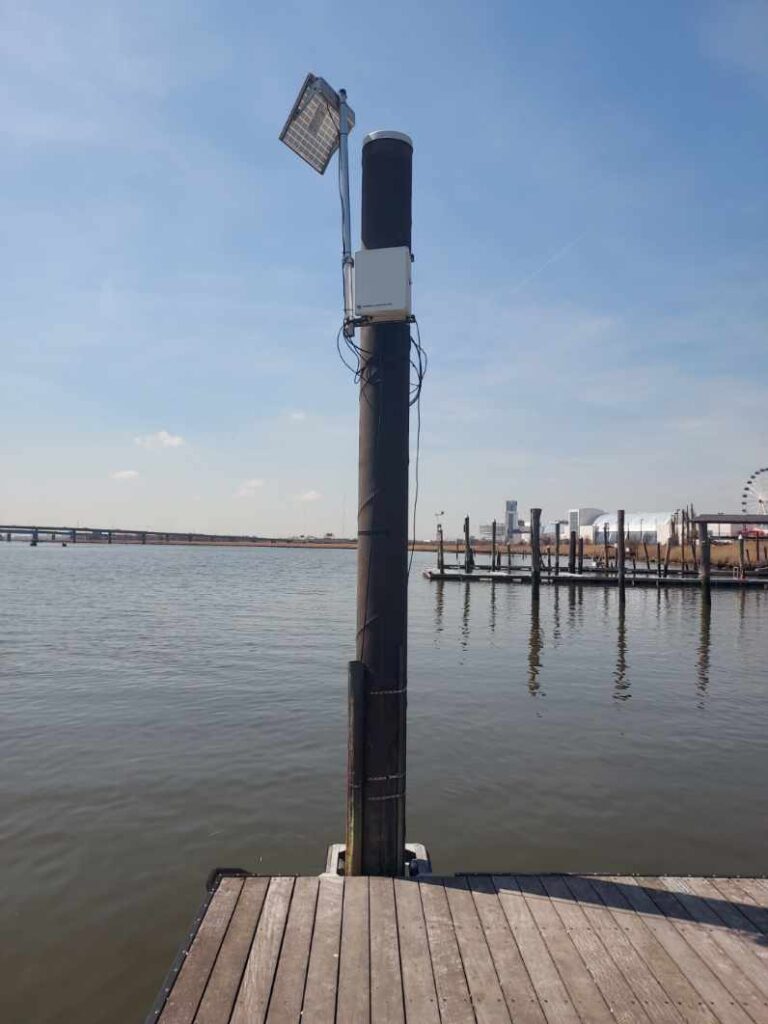
Since September 2004, MRRI operates a continuous water monitoring network in the lower Hackensack River. Currently, two locations are monitored for water quality of the estuary 24/7. This network enables the Authority to continuously monitor and detect any adverse effects of the surrounding District landfills and land uses on water quality on real-time.
Every hour, stations at each location measure: dissolved oxygen, water elevation, acidity, electrical conductivity, turbidity (the amount of particles suspended in the water), salinity and temperature. The information is transmitted on an hourly basis via cellular phone connection to the MRRI lab where results are inspected for suspicious values and are updated on the Internet in “near real time”.
The Master Plan adopted by the NJMC in January 2004 included goals for cleaner water and air. Data collected by this network helps create a report card on the water quality of the lower Hackensack River.
Go to Environmental Monitoring Data to see the “near real time data”.
Please see the map for the station locations.