Landfills settle and their size and volume change as materials decompose with time. To determine landfill capacity over time continuous monitoring of landfill size and volume is required.
Objective
Periodically conduct landfill surveys using high resolution LiDAR images and field GPS measurements to determine volume accumulation and settling rates. Compare previous measured volumes and calculate the current capacity of landfills.
Strategy
Convert elevation and location measurements from LiDAR images and field GPS collected data into GIS readable data and tables. Compute the differences in landfill volume and the final landfill volume via a TIN (Triangulated Irregular Network) using 3D Analyst, an ArcMap extension.
Activities
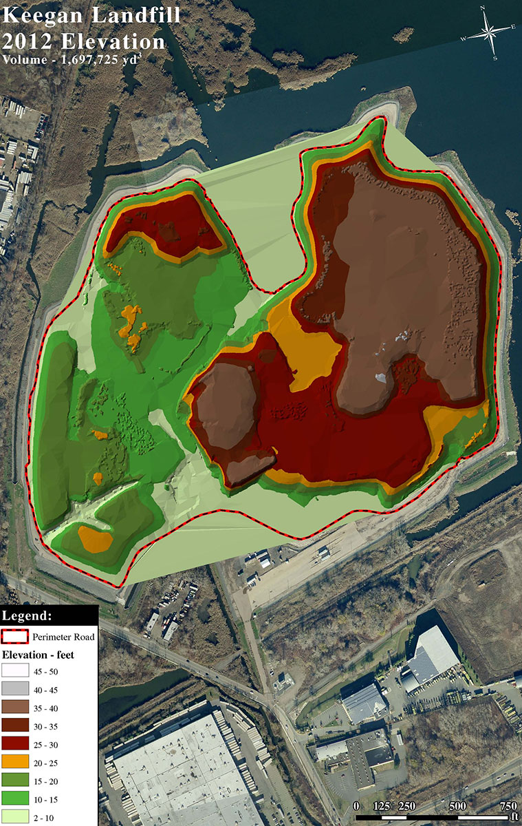
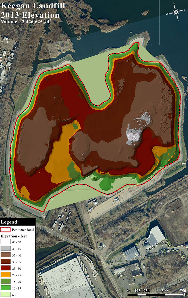
Periodically process measurements gathered from remote sensors (LiDAR) the field measurements into a TIN surface
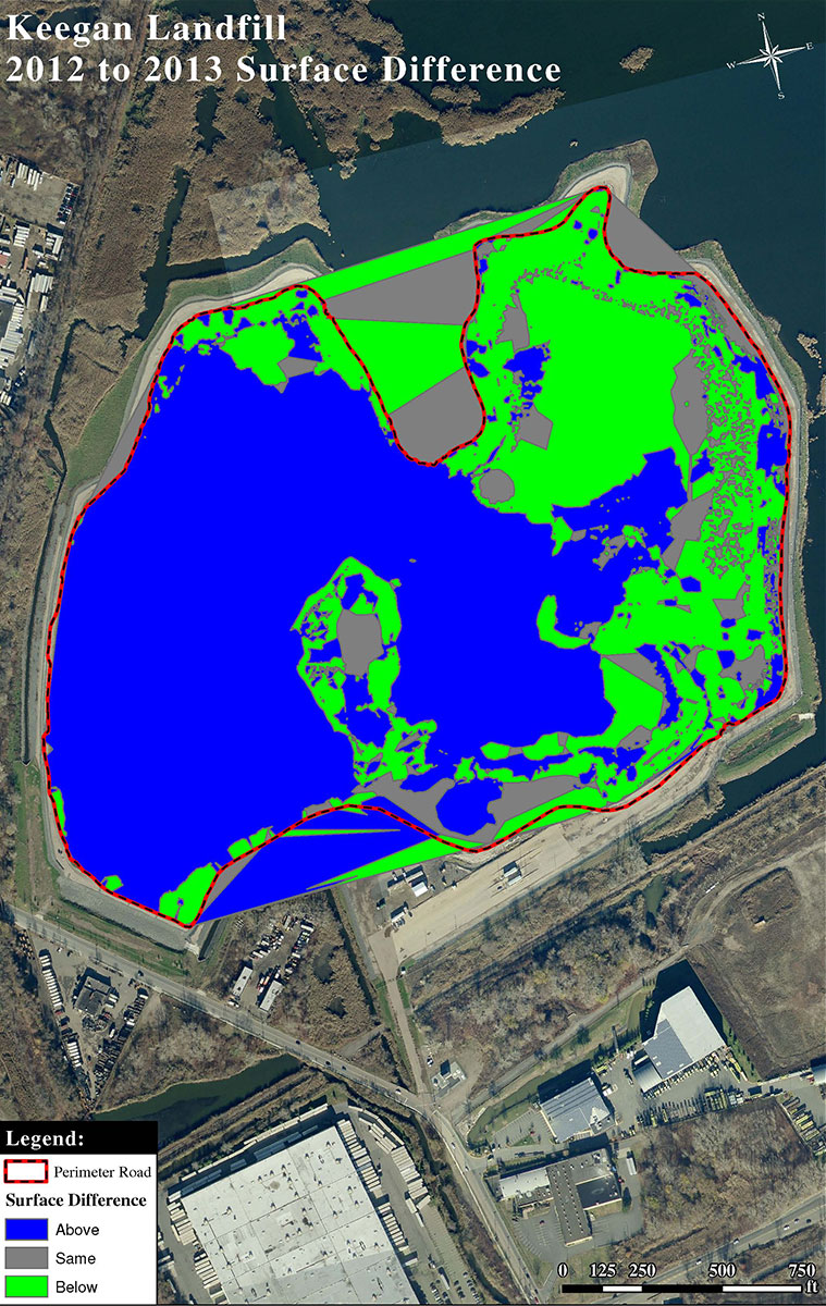
Run surface difference analysis
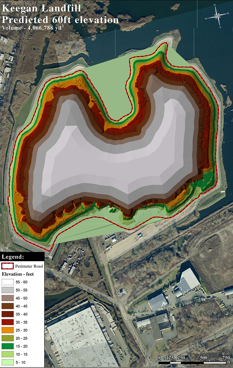
Create mock TIN and calculate remaining landfill capacity
Deliverables
TIN of landfill for a given time period
Landfill volume
Calculate surface difference of landfill from previous years
Determine remaining volume capacity of the landfill.