Fire Pre-plan Database
Our Projects
Problem
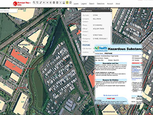
MRRI’s Emergency Response Information System (ERIS) is an interactive web mapping tool for emergency responders from towns within the Hackensack Meadowlands District. One feature of ERIS is the Pre-Plan information sheet which provides an efficient way for emergency responders to record and view information describing critical building features. Responders do not have the time and/or man power to enter building attributes in to the system, therefore the system is not yet being used to its full potential.
Objective
Populate the building pre-plan information sheet with data for the town of East Rutherford with data received from the East Rutherford Fire Department.
Strategy
Manually enter East Rutherford building attribute data into the system. Once this town’s database is populated and becomes an integral part of emergency response protocol, this town will serve as a pilot to promote similar practices in other towns within the Hackensack Meadowlands District.
Activities
- Receive and standardize building attribute data from the East Rutherford Fire Department
- Input data into the pre-plan sheet within ERIS
- Provide any additional support needed by East Rutherford in using the system
- Use this town’s pre plan sheets as a way to promote the system in the rest of the towns with the District
Deliverables
- A populated pre-plan database for the Borough of East Rutherford which will aid in emergency response efforts and serve as a template for other towns to follow.

