NJMC Meadowlands Commission serves their constituency of planners, environmentalists, researchers, teachers, and other interested public with rich environmental data in the form of documents, satellite images, measurements of chemical and physical parameters from water, land and air, maps, wildlife inventories, videos and photographs. Through Digital Meadowlands this information is continuously collected and integrated into searchable digital forms available to all who are interested in the estuary.
Digital Meadowlands is a project sponsored by MRRI and implemented by Rutgers University CIMIC Center to develop the tools and technologies to support models for meadowlands environmental data capturing, data representation and storage, data manipulation, data dissemination, and integration. The goal is to satisfy the needs of meadowlands decision makers and information seekers with intuitive, multi-media presentation of meadowlands data in rapid and accurate manner.
Specific objectives of Digital Meadowlands include
Integrate data and generate customized value added applications to give a holistic view of the urban estuary, biodiversity, vegetation patterns for better decision making to manage meadowlands area
Controlled release of sensitive information to the appropriate users at appropriate level
Streamline the Meadowlands Management and Business Operations at NJMC
Provide a user-centric and user-friendly interface for data and information browsing and retrieval
Identify scientific data and information available and rapidly changing information needs of diverse user groups in the meadowlands
Design and Build appropriate data model and algorithms to process scientific data
(semi-)automate generation of semantic and other metadata to describe data items
Develop Scientific Data Warehousing, and indexing to provide Effective and efficient storage and retrieval
Develop algorithms and methods for meaningful Data Mining, Spatial Data mining
Facilitate Interoperability for seamless integration of data and information flow
Integrate and streamline the process of information gathering, storing and retrieval
Provide a uniform interface for accessing a number of catalogs and other information sources and rank them in the order of user preferences and support non-exact matches.
Overview of Data and Collections
Digital Meadowlands maintains the following data repositories.
Fisheries resource inventory
This collection contains a fisheries resource inventory of the Hackensack River and five of its tributaries within the boundaries of Meadowlands District. Monthly and quarterly data from twenty-one regular sampling locations are currently available.
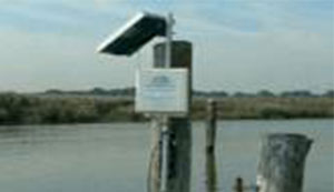
Continuous Water Monitoring Network
Currently three calibrated water monitoring stations in Hackensack River has water sensors collecting water quality parameter data every 15 min interval. The purpose of the monitoring is to identify any acute water quality problems.
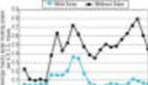
Seasonal Water Monitoring Network
Seasonal sampling data from four times per year (spring, summer, fall and winter) at 14 sites on the Hackensack River and its tributaries allow to monitor approximately 25 parameters to obtain a general assessment of the overall water quality in the Meadowlands, and to capture any large-scale, long-term trends in water quality.
Continuous Weather Monitoring Network
A weather sensors attached on a monitoring station collect the weather related parameter data in every 15 minutes.
Air Quality Monitoring data
Summary results from the air pollutant data collected by a team of researchers will be available.
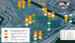
Ecological monitoring (Sediment Chemistry) data
This collection is a database of the chemical and biological data in fourteen marshes. The chemical concentration data of different locations in each site is available.
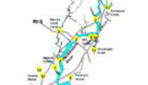
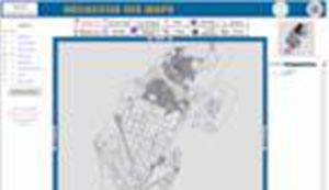
Digital and interactive GIS Maps
Meadowlands district maintains digital, Web-based interactive maps of district as well as municipal governments maps. These maps are searchable through metadata based search.
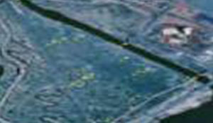
Satellite Images
Satellite imagery collections include low to high resolution images ranging from AVHRR, LANSAT, Orthophotos and hyperspectral AISA and ASTER images.
Photo picture images
A collection of photos about meadowlands district are digitally available and content-based as well as keyword based search and browse are available.
Videos
Video collections include Meadowlands area, events and press coverage videos.
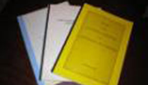
Report Documents
Reports and Document collections include hundreds of documents and reports generated by various scientists and consulting companies.