Spatially Integrated Coastal
Our Projects
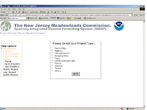
Spatially Integrated Coastal Permitting Assistant System (SICOP)
For The Hackensack Meadowlands District, New Jersey
Participants
MRRI, CIMIC-Rutgers University, NOAA Coastal Services Center (CSC)
Obtaining development permits is a complicated process for property owners and developers. He/she has to address all potential permit requirements from the appropriate federal, state, and/or local agencies, which could be very lengthy and expensive. The regulatory agencies in the Meadowlands include Army Corps of Engineers, New Jersey Department of Environmental Protection, New Jersey Meadowlands Commission and local municipalities.
An on-line pre-application permitting assistant system has been developed to provide an effective single electronic interface for government agencies to deliver customized services, reduce expenses and avoid delays. Based on an initial user profile where the user describes his/her development/site plan, the system provides a “road map” that identifies the permits required and outlines the steps to obtaining these permits At the end, a permit workflow along with all the necessary application forms is generated and is tailored for a particular location, development type and based on relevant regulatory rules and regulations. The SICOP system also includes an “Interactive Map” component, which contains geo-registered data and adds more options for users to conduct their inquiry. This “electronic environmental consultant” provides guidance to the users through an Internet browser and assist in Regulatory agencies to enforce the rules and reduce their burden.